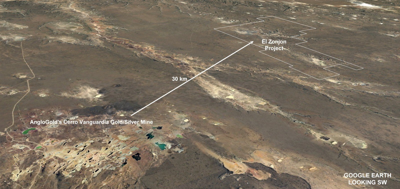
El Zanjon Project, Santa Cruz, Argentina
The El Zanjon project is an opportunity to discover an intact epithermal gold-silver vein system of very significant proportions. It is located in Santa Cruz Province 30 kms south of the Cerro Vanguardia Mine that has been in production for some 20 years. 2017 stated resources were 2.11 million ounces gold and 79 million ounces silver (AngloGold Ashanti 2017 Resource report). Cerro Vanguardia is an extensive epithermal vein field with open pit mining being carried out on dozens of outcropping veins. Given the potentially limited mine life remaining (3 years?), this mine plant could provide an excellent business opportunity for trucking high grade gold silver ore from a discovery at El Zanjon.
The high grade mineralised veins are typically related to the intersection of major NW and E-W fault systems.
Regional airborne magnetic surveying has shown major NW trending structures at El Zanjon which veer to more E-W. A prior academic study predicted a possible repetition of the Cerro Vanguardia structural setting at El Zanjon.
Despite its proximity to Cerro Vanguardia, El Zanjon has not been explored due to extensive Tertiary sedimentary cover some 30-100m thick. Rugby completed an initial ground magnetic survey at a 320m line spacing in 2019 that defined fault structures and flexures considered essential for hosting potential gold silver mineralisation similar at Cerro Vanguardia and the Cerro Moro vein system further to the north. Encouragement led to more detailed magnetic follow up at 160m line spacings and in some target areas 80m. This detail is considered minimal for drill targeting.
As there is no outcrop of the underlying volcanic terrain, a geochemical geochemical sampling to detect ionic levels of gold in soils has been conducted This technique has been successful elsewhere in detecting metal “leakage” from underlying gold-silver deposits. Rugby sampling identified a number of prospective geochemical targets coincident with structural features (see image below). Further sampling was conducted in 2021 at 160m line spacings. Results were very positive with a strong gold-silver correlation demonstrated for both N-W and E-W structures.
Magnetization Inversion Vector (MVI) model with interpreted faults (white lines) and Ionic Leach Geochemistry (Gold ppb)
More detailed ground magnetic surveying to 80m and 40m spaced traverses is planned to effect better refined drill targeting. Drilling is expected to initially focus on the north eastern target area where cover is thinner estimated at around 30 meters thick, and strong gold, silver and pathfinder element geochemistry (low level penetrating through cover rocks) is anomalous. Drilling is planned for 2025.
An Environmental Impact Assessment document and drill water permits were approved in 2023.
Paul Joyce, COO and a “qualified person” within the definition of that term in NI 43-101, has supervised the preparation of the technical information contained in this presentation. Some of the information presented is historical in nature and the Company will be required to do further assessment of this data. Certain information contained herein can be considered forward looking. Read the Cautionary Statement.


